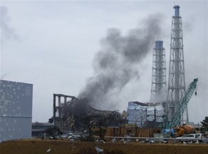
BUCHANAN, N.Y. — As America's nuclear power plants have aged, the once-rural areas around them have become far more crowded and much more difficult to evacuate. Yet government and industry have paid little heed, even as plants are running at higher power and posing more danger in the event of an accident, an Associated Press investigation has found.
|
Populations around the facilities have swelled as much as 4½ times since 1980, a computer-assisted population analysis shows.
But some estimates of evacuation times have not been updated in decades, even as the population has increased more than ever imagined. Emergency plans would direct residents to flee on antiquated, two-lane roads that clog hopelessly at rush hour.
And evacuation zones have remained frozen at a 10-mile radius from each plant since they were set in 1978 — despite all that has happened since, including the accidents at Three Mile Island, Chernobyl and Fukushima Dai-ichi in Japan.
Meanwhile, the dangers have increased.
More than 90 of the nation's 104 operating reactors have been allowed to run at higher power levels for many years, raising the radiation risk in a major accident. In an ongoing investigative series, the AP has reported that aging plants, their lives extended by industry and regulators, are prone to breakdowns that could lead to accidents.
And because the federal government has failed to find a location for permanent storage of spent fuel, thousands of tons of highly radioactive used reactor rods are kept in pools onsite — and more is stored there all the time.
These mounting risks, though, have not resulted in more vigilant preparations for possible accidents.
|
The AP found serious weaknesses in plans for evacuations around the plants, including emergency drills that do not move people and fail to test different scenarios involving the weather or the time of day.
Some plans are merely on checklists, and never have been tested. In drills, responders typically go to command centers and not to their emergency posts. There is no federal requirement for how fast an evacuation must be carried out.
And disaster planners from the U.S. Nuclear Regulatory Commission and the Federal Emergency Management Agency have made dubious assumptions about the public response to a major accident. They insist, for example, that people who are not called upon to evacuate will stay put; they're now saying that they might under some circumstances tell people to hunker down at home even in the 10-mile evacuation zone, and they believe people will do it.
That advice flies in the face of decades of science and policy, millions of dollars in planning and preparations — and common sense.
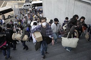
The advice also conflicts with what U.S. officials told Americans in Japan in March, when an earthquake and tsunami knocked out power to Fukushima and melted fuel in three of its six nuclear reactors.
Japanese officials ordered those living within 12 miles of the site to leave. The U.S. government's advice to its citizens? If you're within 50 miles, you should evacuate. And NRC Chairman Gregory Jaczko insisted that this was nothing more than what would be recommended in a similar situation at home.
In fact, under rules in force for more than 30 years, U.S. communities must by law prepare federally reviewed evacuation plans only for those living within 10 miles of a plant. In a severe accident, most of the early deaths — those from radiation sickness, not cancer — are predicted to occur within a 10-mile radius.
Those living within 50 miles, meanwhile, are covered only by an “emergency ingestion zone,” where states are required to make plans to ban contaminated food and water — but not evacuate.
After a May 10 tour at the Indian Point nuclear complex, where two reactors operate just 25 miles from New York City's northern border, Jaczko said the 10-mile rule was merely a “planning standard.” He said decisions on what to do in the “unlikely event” of an accident would be based on circumstances. “So if we needed to take action beyond 10 miles, that's certainly what would be recommended.”
|
If a 50-mile order were ever issued for Indian Point, it would take in about 17.3 million people — 6 percent of all Americans, according to an AP population analysis. That would include parts of New Jersey and Connecticut and all of New York City, except for a chunk of Staten Island.
Such a mass exodus would be an “enormous challenge” — and a historic feat, said Kelly McKinney, New York City's deputy commissioner of preparedness.
“At no time in the history of man,” he said, “has anyone tried to move 17 million people in 48 hours.”
———
ANALYSIS PINPOINTS GROWTH
When reactors were being built, starting in the 1960s, they were generally kept away from population centers. Their remote locations were viewed as a fundamental safety feature — protection aimed at “reducing potential doses and property damage in the event of a severe accident,” according to federal guidelines.
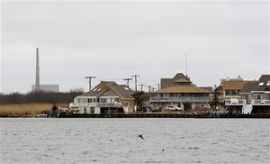
However, over the decades, millions of newcomers have transformed tranquil woodland or shoreline into buzzing suburbs and bedroom communities.
|
The AP gathered four sets of population data starting in 1980 through 2010 and used mapping software to calculate growth as part of a yearlong investigation of aging issues at nuclear power plants.
Last week, the AP reported that federal regulators, working in concert with industry, have repeatedly weakened or failed to enforce safety standards so old reactors can keep operating. The records review included tens of thousands of pages of government and industry studies, test results, inspection reports and regulatory policy statements.
The AP found in its population analysis that over the decades, plant operators and federal regulators have given surprisingly little thought to nearby population growth.
Officials calculate plant safety margins without considering whether an accident would expose 10,000 or 100,000 people to radiation sickness and cancer. And federal regulators have set no limit for how long evacuations may take for given conditions and locations.
The NRC and FEMA acknowledge that radiation releases can happen within a half hour of an accident. Yet a 2004 study for Indian Point estimated total evacuation time from the 10-mile zone, in the snow that is common during local winters, would take 12 hours.
The federal government has not even required population updates for the evacuation zones, though that would change under a proposal expected to be adopted later this year.
The AP analysis also shows that:
-
Four million people now live within 10 miles of the 65 operating
sites. (Population in overlapping zones was counted only once for
this part of the analysis.) Back in 1980, with 38 nuclear sites,
only 1.5 million people lived that close.
-
Overall, from 1980 to 2010, the average population in the
10-mile evacuation zones ballooned by 62 percent, from 39,762 to
64,363.
-
Populations within the 10-mile radius have more than doubled at
12 of the 65 sites during the same 30-year period.
-
The most explosive growth occurred around the two-reactor
Saint
Lucie complex near Fort Pierce, Fla., where the 10-mile
population of 43,332 in 1980 grew 366 percent to 202,010 in 2010.
Others in the top five: the
two-unit
Brunswick complex near the
North Carolina coast, which increased 326 percent from 8,164 to
34,782;
Monticello, 35 miles from Minneapolis, where population
rose 314 percent from 14,130 to 58,538; the
two-unit
Turkey Point site, 20 miles south of Miami, up 302 percent; and the
two-unit
San Onofre facility in San Clemente, Calif., up 283 percent.
-
Among newer reactors, the biggest jump occurred around
Shearon
Harris, 20 miles southwest of Raleigh, N.C., where population
nearly quadrupled from 24,700 in 1990 to 94,465 in 2010. Three
other facilities where populations more than doubled during the
same 20-year period are the
three-unit
Palo Verde site, 50 miles west of Phoenix;
two-unit
McGuire site, 17 miles north of Charlotte, N.C., and the
two-unit
Catawba complex in South Carolina, 18 miles south of Charlotte.
- About 120 million people, almost 40 percent of all Americans, live within 50 miles of a nuclear plant, according to the AP's analysis of 2010 Census data.
———
TRAFFIC JAMS ON A GOOD DAY
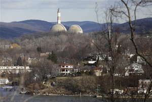
The geography and population around Indian Point have always been a challenge for emergency planners.
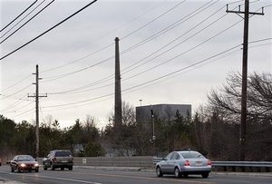
Homes and businesses dot hillsides sloping to the eastern shore of the Hudson River. Along its bank, a curvy, two-lane main artery meanders past traffic lights through quaint town centers suffused with Dutch history and the lore of writer Washington Irving. At rush hour, the roadway crawls with idling cars.
Choke points are everywhere: the narrow Bear Mountain Bridge just north of the plant; the Route 202 slog through old Peekskill; and the Tappan Zee Bridge, which acts as the major river crossing to the south, beyond the 10-mile evacuation zone.
A potential destination for many evacuees, the bridge often backs up with traffic for miles during the morning and evening commutes.
Just a mile to the west across the Hudson, two-lane Route 9W snakes beneath the base of Bear Mountain State Park, offering few escape routes.
|
Though modest population growth of 32 percent within 10 miles of Indian Point has mirrored the nation's increase as a whole between 1980 and 2010, more people live within this evacuation zone than any other in the country: 268,906, according to the AP analysis.
Population density isn't the only concern. A 2008 Columbia University study discovered a seismic fault line near Indian Point, where another earthquake-prone zone was already known to exist. Yet a steel liner designed to be earthquake-proof has been leaking at the site since 1973.
New York state has fought relicensing. Gov. Andrew Cuomo says the area can't be evacuated in a severe nuclear accident.
Given the local topography — natural and man-made — a quick evacuation would be a challenge.
But when Jaczko's talk of a possible 50-mile evacuation in the United States is brought into the equation, the prospect is truly daunting.
In some accidents, New Yorkers would presumably head west to New Jersey using the George Washington Bridge, the Lincoln Tunnel and the Holland Tunnel — passageways that are rarely light on traffic. Any evacuation from the 10-mile zone along those routes could be complicated by a so-called shadow evacuation by those living within 50 miles who defy official instructions to stay put.
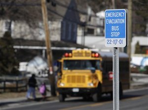
There are other fears — that some police and bus drivers would leave instead of stay to help and that parents would rush to schools instead of meeting their children at designated centers outside the evacuation zone.
|
As with other nuclear sites, the Indian Point emergency plan puts school reception centers outside the 10-mile zone — but not far outside.
Indian Point's lead community evacuation planner, Anthony Sutton, at the Westchester County Department of Emergency Services, acknowledged that area roads couldn't handle the traffic surge from a full-scale nuclear emergency. “I think in a perfect world, we'd all like to see the place in a different location, with all the challenges of evacuating the public around it,” he said.
Paul Blanch, a nuclear safety expert who used to consult at Indian Point but now opposes its effort for a 20-year license extension, was more blunt: “No matter what they say, they're not going to be able to evacuate these areas.”
John Curry, Indian Point's emergency director, said he believes people can evacuate from the 10-mile zone. But he acknowledges the depth of public skepticism: “It's very difficult, and I don't know how to make them feel any better.”
———
SAFETY IN 'LOW' NUMBERS
Two dozen of the nuclear sites along the East Coast are within 50 miles of New York, Boston, Washington, Baltimore or Richmond, Va.
“Anyone who lives on the East Coast knows population has grown up around these reactors, and there are certain places where they should never have been built in the first place,” said Jim Riccio, nuclear policy analyst for environmental group Greenpeace.
For the most part, though, the early sites were favored if they satisfied the criterion of “remoteness from heavily populated areas,” according to the NRC's predecessor, the Atomic Energy Commission.
In 1998, federal guidelines said low-population areas were “generally preferred” because they limit exposure to radiation accidents. This was viewed as part of the NRC's philosophy of multiple layers of accident safeguards. NRC regulations continue to require “low population zones” around prospective nuclear sites.
But from the beginning, it was hard to use very remote sites. Sites were desirable when they were still close enough to transportation networks to haul in massive equipment and supplies and near enough to amenities to lure engineers and corporate managers.
|
The contradiction meant choosing places like the piney hills of Wake County, N.C., where federal regulators gave permission to build Shearon Harris in 1978.
They described the region as a “sparely populated rural area.” But it was just 20 miles from Raleigh — and future commuter sprawl — which accounted for the population nearly quadrupling within the 10-mile zone from 1990 (three years after it went online) to 2010.
Complicating things nationwide, government and industry officials also tended to underestimate projected growth — picking numbers that helped win approval for favored sites.
For example, federal regulators predicted in 1973 that the 50-mile population around the Crystal River nuclear plant in Florida would expand from 155,900 to only 381,000 by 2020. “The basic rural character of the area is not expected to change in the coming 40 years,” the government predicted.
Yet the plant was built in Citrus County on the state's picture-postcard west coast, 70 miles north of Tampa. And by 2010 — 10 years ahead of the predicted timetable — the population had already multiplied by six, to over 1 million, the AP analysis shows.
“These population explosions are very likely to make the evacuation plan unworkable,” said anti-nuclear activist Paul Gunter at Beyond Nuclear in Takoma Park, Md., who has pressed for reviews of emergency community planning before relicensing.
Even Dana Powers, a member of the NRC's independent Advisory Committee on Reactor Safeguards, says his group “has had troubles with evacuation strategy assumptions.”
U.S. Energy Secretary Stephen Chu recently suggested that the Japanese accident will indeed drive U.S. regulators to pick less populated areas for future nuclear plants.
|
Emergency readiness was supposed to account for growth and stay up to date. The joint guidance of the NRC and FEMA in 1980 stated that “evacuation time estimates should be updated as local conditions change.” In fact, according to AP's review of government records, once plant turbines started humming, little was done to keep planning in step with population increases.
In 2007, then-Commissioner Jaczko acknowledged that some evacuation time estimates had not been updated “in decades.”
A proposed rule would require fresh estimated evacuation times with new Census data every 10 years — and after that, with any jumps in population that would increase the time estimate by either 25 percent or 30 minutes.
The proposal also would require an annual update of the population estimate. If adopted as expected, it would be the first overhaul of emergency preparedness rules since 1980.
Given the lack of a required evacuation time, though, any updates might make little difference.
Even with increased concern among federal regulators, challenges remain in the mission to inform the public quickly and accurately.
A FEMA web page entitled “Nuclear Power Plant Emergency,” last modified on April 8, states: “Nearly 3 million Americans live within 10 miles of an operating nuclear power plant.” That's off by one million people.
Then there is the relatively new and sparsely publicized concession to escalating populations and roads that haven't been upgraded or widened in decades. It's called “sheltering” — if people stay put, maybe they can evacuate later, after the first wave of people has left.
A 2007 Sandia National Laboratories report said excess radiation doses could be reduced if residents simply hunkered down in their homes. However, the report acknowledged that “some contamination and radiation will enter most shelters.”
Then, sending another mixed message that could prompt unofficial evacuations, the report continued: If quick evacuation is possible, leaving is “always the most appropriate recommendation.”
———
PLAYING WITH NUMBERS
As part of its investigation, the AP has reported that researchers' numbers and assumptions — along with NRC regulations — have been periodically adjusted to keep the reactors within stated limits for operating safety. Similarly, confronted with evacuation troubles, the NRC has minimized the presumed impact of accidents, allowing plants to stay on the power grid.
|
The studies date back to the early 1980s, when the NRC wanted more guidance about where to locate nuclear reactors. So the agency decided to assess the potential effects of serious accidents on surrounding communities.
Its 1982 report alarmed Congress. At Indian Point Unit 3, the study predicted 64,000 deaths and $314 billion in damages from a bad accident ($700 billion today, adjusted for inflation).
The public was so shaken that the NRC and industry avoided similar analyses for decades.
However, in its Indian Point relicensing proposal, owner Entergy Corp. finally reevaluates some of the numbers. The effects of a bad accident are minimized, according to an AP analysis of those numbers: no more than 2,130 cancer deaths and only $117 billion in economic damages.
Plant spokesman Jerry Nappi went even further when pressed. Contrary to the calculations of planners, he said he didn't “believe a scenario like this is credible or perhaps even possible” with all the protections built into the plant. As for a 50-mile evacuation encompassing New York, he said a 10-mile radius “is already a very conservative planning zone.”
|
Nuclear planners gave similar confident reassurances about their tsunami planning in Japan. And the BP emergency plans left out Gulf of Mexico oil spill scenarios that occurred, even though they supposedly couldn't happen.
Meanwhile, the NRC's partner, Sandia National Laboratories, has again been studying the impact of accidents. The work is still under way, but researchers have tentatively concluded that reactor defenses will work way better than believed in the 1980s.
NRC officials say the conclusion stems from decades of additional research and sophisticated computer modeling. But they also wrap their equations in a ribbon of rosy assumptions:
-
Accidents will develop more slowly than thought.
-
Buildings designed to contain radiation leaks will hold.
-
Emergency plans will work.
-
Responders will do their jobs.
- Ninety percent of those told to stay put will obey.
“The magnitude of possible releases from these accidents is much smaller than originally thought,” said NRC spokesman Scott Burnell in a preview of the conclusions expected to take final form by 2012.
———
PLANS LACK TEETH
The population boom near nuclear sites cries out for stronger evacuation standards, according to safety watchdogs. But little has been done, thus helping ensure the continued operation of the aging reactors.
While keeping evacuation zones the same size at aging plants, regulators often have allowed the units to run at higher power levels. More power means more radioactivity that could be released in an accident.
Since 1977, all the reactors collectively have upgraded their maximum power output 139 times.
In May, the two Point Beach reactors, on the Wisconsin shore of Lake Michigan, were each given permission to increase power levels by 17 percent. Meanwhile, population within 50 miles has grown by 36 percent from 573,050 to 779,140 over the past three decades.
In 2008, the NRC's policymaking commissioners even voted to give lower-level staff the authority to approve sensitive changes that would weaken emergency plans. It had been in the purview of the commission itself.
|
Today, government regulators verify emergency preparedness of communities essentially by checklists, not by standards for what plans must accomplish. They require that communities show the elements of a good plan, but not that the plan is effective.
For example, evacuation time estimates are required, but there is no standard for how quickly people must be able to leave. Regulators say the estimates will help planners make decisions in a real accident, even in the absence of a standard.
Jim Kish, a FEMA administrator who focuses on emergency preparedness, said in an interview that a standard would put communities in an undesirable “planning box.”
“They need the flexibility to make decisions on what to evacuate, and when to evacuate, and how to evacuate,” he said.
“I think the NRC wants to make sure that the evacuation side of things doesn't make plants have to close, even if the population grows quickly,” said Richard Webster, an environmental lawyer who unsuccessfully fought the relicensing petition at the Oyster Creek reactor in Lacey Township, N.J.
More broadly, the government seems careful to avoid anything fully binding in its planning requirements. It sets a supposed standard that people within 10 miles must be notified of an accident within 45 minutes. But NRC rules also say that's not a guarantee early notification can be provided for everyone.
And notification of an accident within 45 minutes says nothing about how long it will take to flee.
NRC rules also concede there's no guarantee that emergency sirens, “when tested under actual field conditions, will meet the design objective in all cases.”
This movable standard makes things easier for plant owners who often struggle to keep warning sirens working from their perches within the 10-mile zones.
FEMA encourages drills for rush-hour traffic, night conditions, or bad weather. But it does not require them, the agency acknowledged.
Heather Heigl, the lead community emergency planner for the area around the Brunswick site in North Carolina, said daylong drills every two years verify that the right people and resources are available, and that communications systems are working.
However, she acknowledged, the exercises don't actually send rescue workers to shelters or police officers to traffic control points. Asked for the estimated evacuation times for her site, she wasn't sure.
“The NRC rubber-stamps these evacuation plans, but they're not based on discernible performance standards,” said Alex Matthiessen, president of the Riverkeeper environmental group fighting Indian Point relicensing. “If they applied any kind of meaningful standard in evaluating the emergency plans of the nation's nuclear power plants, there would be no nuclear power plants in this country, at least not in populated areas.”
Attorney Webster argued that safety standards should become harder to meet as populations grow around plants like Oyster Creek. (In AP's analysis, population between 1980 and last year increased 269 percent within 10 miles of Oyster Creek, from 36,738 to 135,378.)
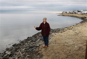
During an emergency there, many would be forced to leave in the same direction, away from the Atlantic Ocean, along a highway that a pro-nuclear state senator has called “a two-lane cow path.”
Janet Tauro, a nuclear safety activist who lives 18 miles from the plant, wonders: “Picture me with my son on his BMX bike and my daughter at dance class, multiply me by 100,000 — and you have pandemonium.”
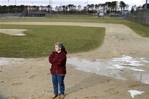
Helen Henderson, who lives three miles from the reactor, is among the doubters. She said she repeatedly ignored the forms sent home by her children's school certifying that she has read and agrees with the Oyster Creek emergency plan.
Tired of the stream of reminders sent her way, Henderson said she finally wrote back: “Refuse to sign. Evacuation plan will not work.”
Copyright © 2011 Associated Press
Reprinted for Fair Use Only.
